
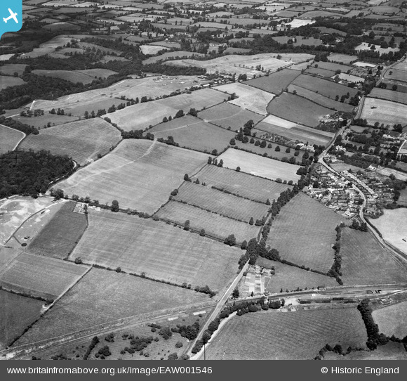
EAW001546 ENGLAND (1946). Housing at The Close and the surrounding countryside, Catbrain, 1946
© Hawlfraint cyfranwyr OpenStreetMap a thrwyddedwyd gan yr OpenStreetMap Foundation. 2026. Trwyddedir y gartograffeg fel CC BY-SA.
Delweddau cyfagos (2)
EAW001546

EAW001553

Manylion
| Pennawd | [EAW001546] Housing at The Close and the surrounding countryside, Catbrain, 1946 |
| Cyfeirnod | EAW001546 |
| Dyddiad | 15-July-1946 |
| Dolen | |
| Enw lle | CATBRAIN |
| Plwyf | ALMONDSBURY |
| Ardal | |
| Gwlad | ENGLAND |
| Dwyreiniad / Gogleddiad | 356722, 180181 |
| Hydred / Lledred | -2.6238018045717, 51.518408176668 |
| Cyfeirnod Grid Cenedlaethol | ST567802 |
Pinnau

Matt Aldred edob.mattaldred.com |
Monday 21st of November 2022 06:38:15 PM | |

Buzzard |
Wednesday 3rd of June 2015 03:58:12 PM | |
|
Buzzard |
Wednesday 3rd of June 2015 03:57:11 PM | |
|
Buzzard |
Wednesday 3rd of June 2015 03:55:23 PM | |
|
Buzzard |
Wednesday 3rd of June 2015 03:53:43 PM | |
|
Buzzard |
Wednesday 3rd of June 2015 03:52:50 PM | |

Class31 |
Wednesday 3rd of June 2015 06:44:12 AM | |
|
Graham Yaxley |
Thursday 18th of December 2014 01:00:40 AM | |
|
Graham Yaxley |
Thursday 18th of December 2014 12:58:38 AM | |
|
Graham Yaxley |
Thursday 18th of December 2014 12:57:37 AM | |
|
cptpies |
Thursday 9th of January 2014 12:59:33 PM |
Cyfraniadau Grŵp

WWII HAA Battery B4/5. Catbrain. |
cptpies |
Thursday 9th of January 2014 12:59:55 PM |