
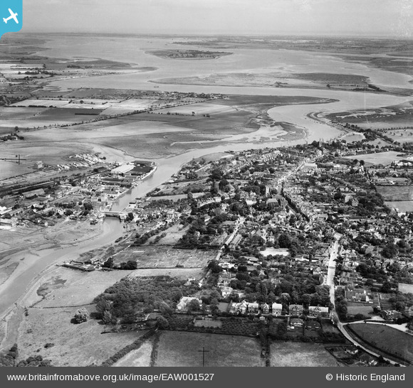
EAW001527 ENGLAND (1946). The town and the Blackwater estuary, Maldon, from the north-west, 1946
© Hawlfraint cyfranwyr OpenStreetMap a thrwyddedwyd gan yr OpenStreetMap Foundation. 2026. Trwyddedir y gartograffeg fel CC BY-SA.
Delweddau cyfagos (3)
EAW001527

EAW001528

EPW054685

Manylion
| Pennawd | [EAW001527] The town and the Blackwater estuary, Maldon, from the north-west, 1946 |
| Cyfeirnod | EAW001527 |
| Dyddiad | 5-July-1946 |
| Dolen | |
| Enw lle | MALDON |
| Plwyf | MALDON |
| Ardal | |
| Gwlad | ENGLAND |
| Dwyreiniad / Gogleddiad | 584776, 207232 |
| Hydred / Lledred | 0.67612910593046, 51.732841972827 |
| Cyfeirnod Grid Cenedlaethol | TL848072 |
Pinnau

Stephen Mirrington |
Sunday 28th of September 2025 08:28:16 PM | |

Matt Aldred edob.mattaldred.com |
Sunday 10th of March 2024 12:31:29 PM | |
|
Matt Aldred edob.mattaldred.com |
Sunday 30th of January 2022 11:19:11 AM | |

Sparky |
Saturday 23rd of September 2017 02:21:17 PM | |
|
Sparky |
Saturday 23rd of September 2017 02:20:14 PM | |
|
MB |
Friday 7th of October 2016 04:38:12 PM | |

Alan McFaden |
Monday 16th of December 2013 10:53:39 PM | |
|
Alan McFaden |
Monday 16th of December 2013 10:52:19 PM | |
|
Alan McFaden |
Monday 16th of December 2013 10:51:43 PM | |
|
Alan McFaden |
Monday 16th of December 2013 10:51:00 PM | |
|
Alan McFaden |
Monday 16th of December 2013 10:50:09 PM | |
|
MB |
Sunday 10th of November 2013 09:33:08 AM | |
|
MB |
Sunday 10th of November 2013 09:32:42 AM | |
|
MB |
Sunday 10th of November 2013 09:32:20 AM | |
|
MB |
Sunday 10th of November 2013 09:31:48 AM | |
|
MB |
Sunday 10th of November 2013 09:31:30 AM | |
|
MB |
Sunday 10th of November 2013 09:31:11 AM |


