
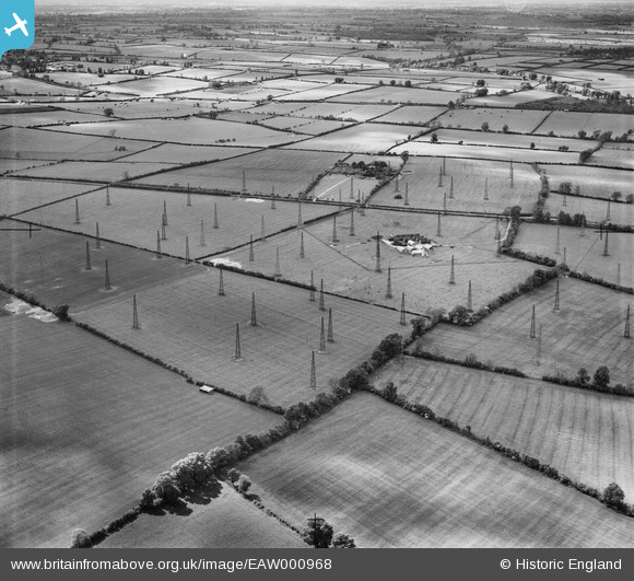
EAW000968 ENGLAND (1946). Radio masts at RAF Stoke Hammond, Stoke Hammond, from the south-east, 1946
© Hawlfraint cyfranwyr OpenStreetMap a thrwyddedwyd gan yr OpenStreetMap Foundation. 2026. Trwyddedir y gartograffeg fel CC BY-SA.
Delweddau cyfagos (2)
EAW000968

EAW000962

Manylion
| Pennawd | [EAW000968] Radio masts at RAF Stoke Hammond, Stoke Hammond, from the south-east, 1946 |
| Cyfeirnod | EAW000968 |
| Dyddiad | 28-May-1946 |
| Dolen | |
| Enw lle | STOKE HAMMOND |
| Plwyf | STOKE HAMMOND |
| Ardal | |
| Gwlad | ENGLAND |
| Dwyreiniad / Gogleddiad | 487196, 228822 |
| Hydred / Lledred | -0.73110602565747, 51.950616005352 |
| Cyfeirnod Grid Cenedlaethol | SP872288 |
Pinnau
Byddwch y cyntaf i ychwanegu sylw at y ddelwedd hon!
Cyfraniadau Grŵp
RAF Stoke Hammond was linked to Bletchley Park, a few miles to the north of the site. It is believed that the radio operators were listening to the transmissions of the Japanese Naval Code. The radio masts were constructed of wood to a height of around 90ft. This site lies off Dorcas Lane a mile to the east of Stoke Hammond. |

JOSEPH |
Thursday 15th of October 2015 06:11:33 PM |