
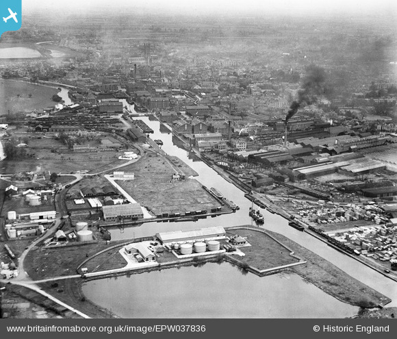
epw037836 ENGLAND (1932). Monk Meadow Dock, Llanthony Priory and the docks, Gloucester, 1932
© Copyright OpenStreetMap contributors and licensed by the OpenStreetMap Foundation. 2026. Cartography is licensed as CC BY-SA.
Nearby Images (27)
EPW037836

EAW012206

EPW048240

EAW012208

EAW012198

EAW032298

EPW016966

EAW012199

EAW032299

EAW032297

EAW012196

EAW032294

EAW032295

EAW032301

EAW032296

EAW032293

EAW032302

EAW012211

EAW012201

EAW032300

EAW012205

EPW037770

EPW038346

EPW038343

EPW038348

EPW024167

EPW038344

Details
| Title | [EPW037836] Monk Meadow Dock, Llanthony Priory and the docks, Gloucester, 1932 |
| Reference | EPW037836 |
| Date | May-1932 |
| Link | |
| Place name | GLOUCESTER |
| Parish | |
| District | |
| Country | ENGLAND |
| Easting / Northing | 382485, 217820 |
| Longitude / Latitude | -2.2543548282717, 51.85824972457 |
| National Grid Reference | SO825178 |
Pins

MR |
Monday 20th of June 2022 11:30:46 AM | |
|
Richcl |
Sunday 5th of May 2013 03:36:36 PM | |
|
Richcl |
Sunday 5th of May 2013 03:36:21 PM | |
|
Richcl |
Sunday 5th of May 2013 03:35:10 PM | |
|
Richcl |
Sunday 5th of May 2013 03:34:35 PM | |
|
Richcl |
Sunday 5th of May 2013 03:33:48 PM |