
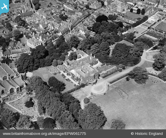
EPW061775 ENGLAND (1939). Abbey House, Cirencester, 1939
© Copyright OpenStreetMap contributors and licensed by the OpenStreetMap Foundation. 2026. Cartography is licensed as CC BY-SA.
Nearby Images (18)
EPW061775

EPW061776

EPW061780

EAW031681

EAW006877

EPW022416

EPW022410

EPW022412

EPW022413

EPW006310

EPW022417

EAW031677

EPW022408

EPW022407

EPW022415

EAW031680

EPW061779

EAW015788

Details
| Title | [EPW061775] Abbey House, Cirencester, 1939 |
| Reference | EPW061775 |
| Date | 8-June-1939 |
| Link | |
| Place name | CIRENCESTER |
| Parish | CIRENCESTER |
| District | |
| Country | ENGLAND |
| Easting / Northing | 402318, 202184 |
| Longitude / Latitude | -1.9664420605256, 51.71791995197 |
| National Grid Reference | SP023022 |
Pins

Alan McFaden |
Friday 23rd of August 2013 10:26:01 AM |
