
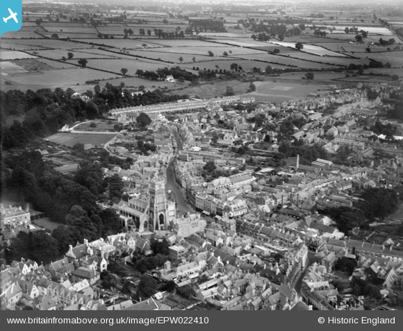
EPW022410 ENGLAND (1928). The Town Centre, Cirencester, from the north-west, 1928
© Copyright OpenStreetMap contributors and licensed by the OpenStreetMap Foundation. 2026. Cartography is licensed as CC BY-SA.
Nearby Images (19)
EPW022410

EPW022416

EPW022412

EPW006310

EAW031681

EAW006877

EPW022413

EAW031677

EPW022407

EPW022417

EPW061776

EPW061775

EPW061780

EAW031680

EPW022415

EAW015789

EAW015788

EAW006878

EPW022409

Details
| Title | [EPW022410] The Town Centre, Cirencester, from the north-west, 1928 |
| Reference | EPW022410 |
| Date | August-1928 |
| Link | |
| Place name | CIRENCESTER |
| Parish | CIRENCESTER |
| District | |
| Country | ENGLAND |
| Easting / Northing | 402279, 202049 |
| Longitude / Latitude | -1.9670075510878, 51.716706168629 |
| National Grid Reference | SP023020 |
Pins

Alan McFaden |
Wednesday 21st of May 2014 09:49:23 PM | |

Class31 |
Thursday 24th of January 2013 08:21:52 PM | |
|
Class31 |
Thursday 24th of January 2013 08:20:40 PM | |
|
Class31 |
Thursday 24th of January 2013 08:18:47 PM | |
|
Class31 |
Sunday 28th of October 2012 11:25:51 PM | |
|
Class31 |
Sunday 28th of October 2012 11:25:20 PM | |
|
Class31 |
Sunday 28th of October 2012 11:25:02 PM | |
|
Class31 |
Friday 5th of October 2012 09:05:08 PM | |

Tetbury |
Sunday 1st of July 2012 12:11:06 AM | |
This was at that time Cirencester Grammar School. It only became the Junior School in 1975 and is now Cirencester Primary School, as of 2010 |
Rob C |
Friday 12th of October 2012 01:32:43 PM |
|
Tetbury |
Sunday 1st of July 2012 12:09:31 AM | |
|
Tetbury |
Wednesday 27th of June 2012 09:17:26 PM | |
|
Tetbury |
Wednesday 27th of June 2012 09:10:54 PM | |
|
Tetbury |
Wednesday 27th of June 2012 09:00:18 PM | |
|
Tetbury |
Wednesday 27th of June 2012 08:59:49 PM | |
|
Tetbury |
Wednesday 27th of June 2012 01:15:29 AM | |
|
MattB |
Monday 25th of June 2012 04:57:32 PM |
