
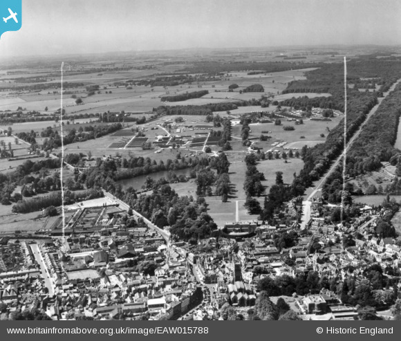
EAW015788 ENGLAND (1948). The 188th US Army General Hospital in Cirencester Park, Cirencester, from the east, 1948. This image has been produced from a print marked by Aerofilms Ltd for photo editing.
© Copyright OpenStreetMap contributors and licensed by the OpenStreetMap Foundation. 2026. Cartography is licensed as CC BY-SA.
Nearby Images (15)
EAW015788

EAW015789

EAW031680

EAW015790

EPW022407

EAW031677

EAW031679

EPW022412

EPW006310

EPW022416

EPW037748

EPW022410

EAW031681

EPW061776

EPW061775

Details
| Title | [EAW015788] The 188th US Army General Hospital in Cirencester Park, Cirencester, from the east, 1948. This image has been produced from a print marked by Aerofilms Ltd for photo editing. |
| Reference | EAW015788 |
| Date | 18-May-1948 |
| Link | |
| Place name | CIRENCESTER |
| Parish | CIRENCESTER |
| District | |
| Country | ENGLAND |
| Easting / Northing | 402077, 201984 |
| Longitude / Latitude | -1.96993223605, 51.716122461979 |
| National Grid Reference | SP021020 |
