
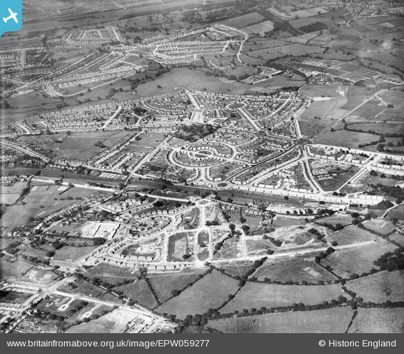
EPW059277 ENGLAND (1938). Residential area off Whittington Oval, Gillscroft Road and Hollington Crescent, Glebe Farm, 1938
© Copyright OpenStreetMap contributors and licensed by the OpenStreetMap Foundation. 2026. Cartography is licensed as CC BY-SA.
Nearby Images (13)
EPW059277

EAW001182

EAW001173

EAW001178

EAW001181

EPW059276

EPW059278

EPW059279

EAW001180

EPW059270

EPW059271

EPW059272

EAW001170

Details
| Title | [EPW059277] Residential area off Whittington Oval, Gillscroft Road and Hollington Crescent, Glebe Farm, 1938 |
| Reference | EPW059277 |
| Date | 12-September-1938 |
| Link | |
| Place name | GLEBE FARM |
| Parish | |
| District | |
| Country | ENGLAND |
| Easting / Northing | 414183, 287350 |
| Longitude / Latitude | -1.7911250803816, 52.483517841103 |
| National Grid Reference | SP142874 |
Pins
Be the first to add a comment to this image!