
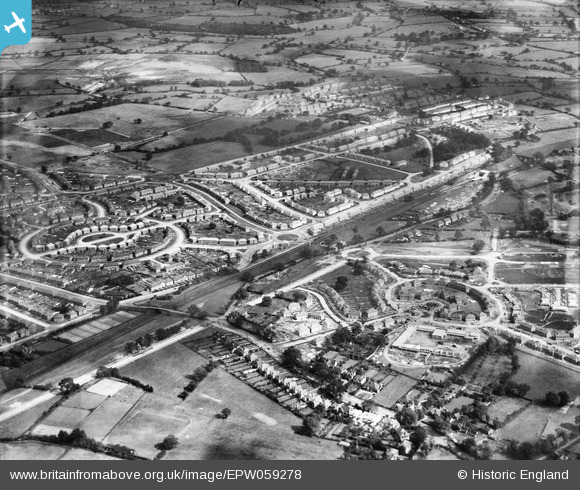
EPW059278 ENGLAND (1938). Residential area off Whittington Oval, Gillscroft Road and Folliott Road, Glebe Farm, 1938
© Copyright OpenStreetMap contributors and licensed by the OpenStreetMap Foundation. 2026. Cartography is licensed as CC BY-SA.
Nearby Images (6)
EPW059278

EPW059272

EAW001182

EPW059277

EPW059279

EAW001173

Details
| Title | [EPW059278] Residential area off Whittington Oval, Gillscroft Road and Folliott Road, Glebe Farm, 1938 |
| Reference | EPW059278 |
| Date | 12-September-1938 |
| Link | |
| Place name | GLEBE FARM |
| Parish | |
| District | |
| Country | ENGLAND |
| Easting / Northing | 414302, 287200 |
| Longitude / Latitude | -1.7893790054455, 52.482166092974 |
| National Grid Reference | SP143872 |
Pins
Be the first to add a comment to this image!