
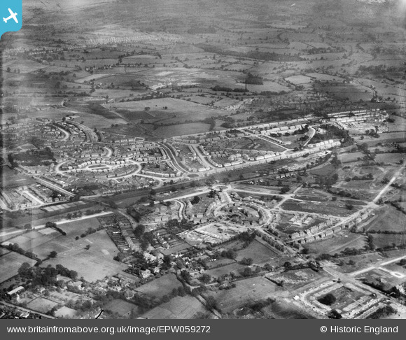
EPW059272 ENGLAND (1938). Residential area under construction at Whittington Oval and Gillscroft Road, Glebe Farm, 1938
© Copyright OpenStreetMap contributors and licensed by the OpenStreetMap Foundation. 2026. Cartography is licensed as CC BY-SA.
Nearby Images (7)
EPW059272

EPW059279

EPW059278

EAW001182

EAW001170

EPW059277

EAW001178

Details
| Title | [EPW059272] Residential area under construction at Whittington Oval and Gillscroft Road, Glebe Farm, 1938 |
| Reference | EPW059272 |
| Date | 12-September-1938 |
| Link | |
| Place name | GLEBE FARM |
| Parish | |
| District | |
| Country | ENGLAND |
| Easting / Northing | 414427, 287266 |
| Longitude / Latitude | -1.7875353252385, 52.482756203958 |
| National Grid Reference | SP144873 |
