
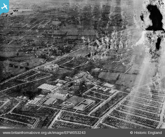
EPW053243 ENGLAND (1937). Factories around Wadworth Road and Western Avenue, Perivale, 1937. This image has been produced from a damaged negative.
© Copyright OpenStreetMap contributors and licensed by the OpenStreetMap Foundation. 2026. Cartography is licensed as CC BY-SA.
Nearby Images (29)
EPW053243

EAW004300

EPW029363

EPW029367

EPW029371

EPW029366

EPW029373

EPW038720

EPW035540

EPW029372

EPW029370

EAW004303

EPW040869

EPW035539

EPW039559

EPW039554

EPW038719

EPW038721

EPW039558

EPW038815

EPW038816

EPW025571

EPW039555

EPW039556

EPW039561

EPW039557

EPW039560

EPW039556A

EPW040870

Details
| Title | [EPW053243] Factories around Wadworth Road and Western Avenue, Perivale, 1937. This image has been produced from a damaged negative. |
| Reference | EPW053243 |
| Date | 27-May-1937 |
| Link | |
| Place name | PERIVALE |
| Parish | |
| District | |
| Country | ENGLAND |
| Easting / Northing | 516506, 183197 |
| Longitude / Latitude | -0.32003900030044, 51.535160130745 |
| National Grid Reference | TQ165832 |
