
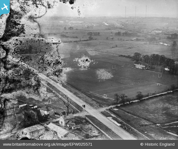
EPW025571 ENGLAND (1928). Ealing Central Sports Ground, Perivale, from the south-east, 1928. This image has been produced from a damaged negative.
© Copyright OpenStreetMap contributors and licensed by the OpenStreetMap Foundation. 2026. Cartography is licensed as CC BY-SA.
Nearby Images (12)
EPW025571

EPW035539

EPW035533

EPW038722

EPW035540

EPW038720

EPW035537

EPW035532

EPW025572

EPW025570

EPW040868

EPW053243

Details
| Title | [EPW025571] Ealing Central Sports Ground, Perivale, from the south-east, 1928. This image has been produced from a damaged negative. |
| Reference | EPW025571 |
| Date | November-1928 |
| Link | |
| Place name | PERIVALE |
| Parish | |
| District | |
| Country | ENGLAND |
| Easting / Northing | 516312, 182977 |
| Longitude / Latitude | -0.32290778860889, 51.533222650995 |
| National Grid Reference | TQ163830 |
Pins
 |

Cargy |
Wednesday 26th of February 2020 02:05:59 PM |
|
JimmyBrandon |
Tuesday 14th of January 2020 11:04:42 AM | |

Des Elmes |
Monday 4th of April 2016 09:41:21 PM | |
|
Eranos |
Friday 9th of October 2015 05:53:19 PM |