
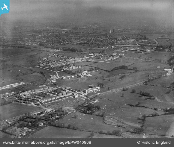
EPW040868 ENGLAND (1933). Housing developement around the Hoover Factory, Perivale, from the south-west, 1933
© Copyright OpenStreetMap contributors and licensed by the OpenStreetMap Foundation. 2026. Cartography is licensed as CC BY-SA.
Nearby Images (26)
EPW040868

EPW040869

EPW039559

EPW039554

EPW039563

EPW040872

EPW039558

EPW038816

EPW039562

EPW035540

EPW038815

EPW038721

EPW039555

EPW039560

EPW039556

EPW038720

EPW039561

EPW039557

EPW039556A

EPW038719

EPW035537

EPW040870

EPW035533

EPW025571

EPW035539

EPW043714

Details
| Title | [EPW040868] Housing developement around the Hoover Factory, Perivale, from the south-west, 1933 |
| Reference | EPW040868 |
| Date | March-1933 |
| Link | |
| Place name | PERIVALE |
| Parish | |
| District | |
| Country | ENGLAND |
| Easting / Northing | 516535, 182856 |
| Longitude / Latitude | -0.31973391138273, 51.532089036485 |
| National Grid Reference | TQ165829 |
