
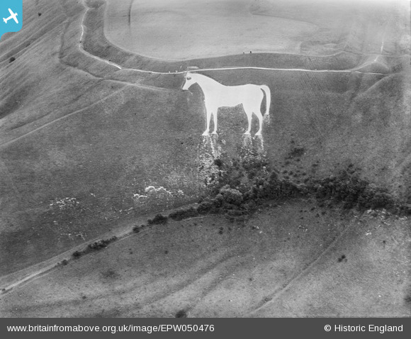
EPW050476 ENGLAND (1936). The Westbury White Horse at Bratton Camp, Bratton, 1936
© Copyright OpenStreetMap contributors and licensed by the OpenStreetMap Foundation. 2026. Cartography is licensed as CC BY-SA.
Nearby Images (6)
EPW050476

EPW027653

EPW027651

EAW015766

EAW002270

EAW002269

Details
| Title | [EPW050476] The Westbury White Horse at Bratton Camp, Bratton, 1936 |
| Reference | EPW050476 |
| Date | June-1936 |
| Link | |
| Place name | BRATTON |
| Parish | BRATTON |
| District | |
| Country | ENGLAND |
| Easting / Northing | 389799, 151615 |
| Longitude / Latitude | -2.1462187961398, 51.263090608038 |
| National Grid Reference | ST898516 |
Pins
Be the first to add a comment to this image!
User Comment Contributions

A recent view from the Bratton Road |

Class31 |
Thursday 4th of July 2013 06:10:34 PM |