
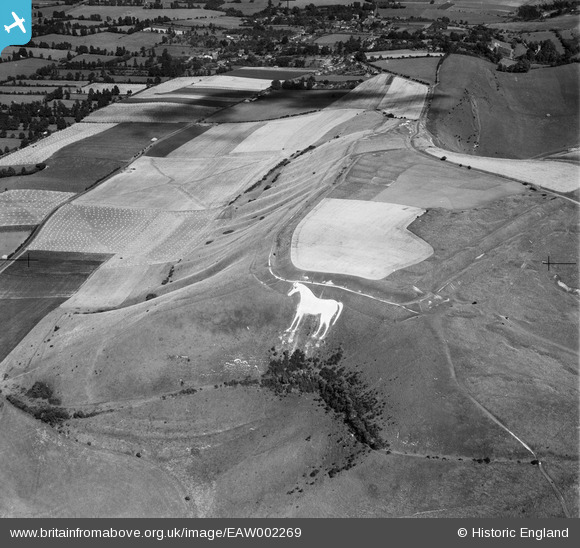
EAW002269 ENGLAND (1946). The Westbury White Horse and Bratton Camp, Bratton, 1946
© Copyright OpenStreetMap contributors and licensed by the OpenStreetMap Foundation. 2026. Cartography is licensed as CC BY-SA.
Nearby Images (6)
EAW002269

EAW015766

EAW002270

EPW027651

EPW050476

EPW027653

Details
| Title | [EAW002269] The Westbury White Horse and Bratton Camp, Bratton, 1946 |
| Reference | EAW002269 |
| Date | 18-August-1946 |
| Link | |
| Place name | BRATTON |
| Parish | BRATTON |
| District | |
| Country | ENGLAND |
| Easting / Northing | 389892, 151664 |
| Longitude / Latitude | -2.1448871454454, 51.263532914556 |
| National Grid Reference | ST899517 |
Pins
Be the first to add a comment to this image!