
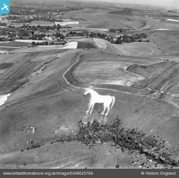
EAW015766 ENGLAND (1948). The Westbury White Horse and Bratton Camp Iron Age hillfort, Bratton, 1948. This image has been produced from a print.
© Copyright OpenStreetMap contributors and licensed by the OpenStreetMap Foundation. 2026. Cartography is licensed as CC BY-SA.
Nearby Images (6)
EAW015766

EAW002269

EAW002270

EPW027651

EPW050476

EPW027653

Details
| Title | [EAW015766] The Westbury White Horse and Bratton Camp Iron Age hillfort, Bratton, 1948. This image has been produced from a print. |
| Reference | EAW015766 |
| Date | 18-May-1948 |
| Link | |
| Place name | BRATTON |
| Parish | BRATTON |
| District | |
| Country | ENGLAND |
| Easting / Northing | 389875, 151636 |
| Longitude / Latitude | -2.1451300280574, 51.26328081317 |
| National Grid Reference | ST899516 |
Pins

wayfarer |
Friday 20th of February 2015 04:40:37 PM |