
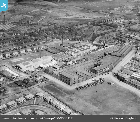
EPW050112 ENGLAND (1936). The Empire Engineering Works, Laisterdyke, 1936
© Copyright OpenStreetMap contributors and licensed by the OpenStreetMap Foundation. 2026. Cartography is licensed as CC BY-SA.
Nearby Images (19)
EPW050112

EPW050109

EAW002658

EAW002654

EPW050110

EPW050107

EPW050108

EAW002656

EAW002655

EPW050106

EAW002652

EAW002651

EPW050111

EAW002653

EAW002657

EAW030592

EAW030586

EAW030591

EAW030590

Details
| Title | [EPW050112] The Empire Engineering Works, Laisterdyke, 1936 |
| Reference | EPW050112 |
| Date | May-1936 |
| Link | |
| Place name | LAISTERDYKE |
| Parish | |
| District | |
| Country | ENGLAND |
| Easting / Northing | 418883, 433426 |
| Longitude / Latitude | -1.713295577979, 53.796583644334 |
| National Grid Reference | SE189334 |
Pins
Be the first to add a comment to this image!