
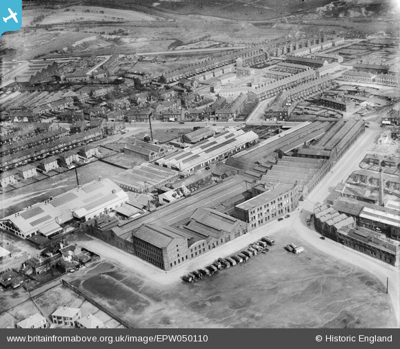
EPW050110 ENGLAND (1936). The Empire Engineering Works, Laisterdyke, 1936
© Copyright OpenStreetMap contributors and licensed by the OpenStreetMap Foundation. 2026. Cartography is licensed as CC BY-SA.
Nearby Images (21)
EPW050110

EPW050106

EPW050109

EPW050112

EAW002658

EPW050107

EAW002654

EAW002651

EAW002656

EPW050108

EAW002655

EAW002653

EPW050111

EAW002652

EAW002657

EAW030592

EAW030586

EAW030591

EAW030590

EAW030589

EAW030585

Details
| Title | [EPW050110] The Empire Engineering Works, Laisterdyke, 1936 |
| Reference | EPW050110 |
| Date | May-1936 |
| Link | |
| Place name | LAISTERDYKE |
| Parish | |
| District | |
| Country | ENGLAND |
| Easting / Northing | 418897, 433401 |
| Longitude / Latitude | -1.7130845498579, 53.796358413442 |
| National Grid Reference | SE189334 |
Pins

Ridertrainer |
Friday 14th of June 2013 10:39:06 PM | |
|
Ridertrainer |
Friday 14th of June 2013 10:36:34 PM | |
|
Ridertrainer |
Friday 14th of June 2013 10:35:04 PM | |
|
Ridertrainer |
Friday 14th of June 2013 10:33:28 PM | |
Top floor here was the drawing office. I served my apprenticeship here from 1966-1970 |
Grimbling |
Wednesday 26th of June 2013 02:03:49 PM |
|
Ridertrainer |
Friday 14th of June 2013 10:32:42 PM |