
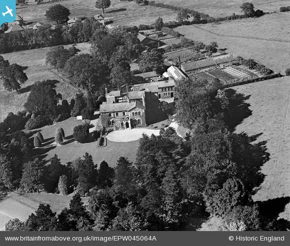
EPW045064A ENGLAND (1934). Hale Carr, Hale, 1934
© Copyright OpenStreetMap contributors and licensed by the OpenStreetMap Foundation. 2026. Cartography is licensed as CC BY-SA.
Nearby Images (6)
EPW045064A

EPW045064

EPW045060

EPW045061

EPW045063

EPW045062

Details
| Title | [EPW045064A] Hale Carr, Hale, 1934 |
| Reference | EPW045064A |
| Date | June-1934 |
| Link | |
| Place name | HALE |
| Parish | |
| District | |
| Country | ENGLAND |
| Easting / Northing | 378589, 386630 |
| Longitude / Latitude | -2.3218747907785, 53.375827681137 |
| National Grid Reference | SJ786866 |
Pins
Be the first to add a comment to this image!