
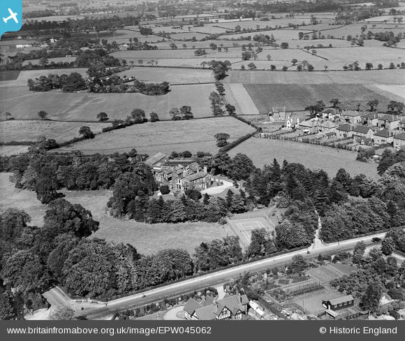
EPW045062 ENGLAND (1934). Hale Carr and surrounding countryside, Hale, 1934
© Copyright OpenStreetMap contributors and licensed by the OpenStreetMap Foundation. 2026. Cartography is licensed as CC BY-SA.
Nearby Images (6)
EPW045062

EPW045060

EPW045064

EPW045061

EPW045064A

EPW045063

Details
| Title | [EPW045062] Hale Carr and surrounding countryside, Hale, 1934 |
| Reference | EPW045062 |
| Date | June-1934 |
| Link | |
| Place name | HALE |
| Parish | |
| District | |
| Country | ENGLAND |
| Easting / Northing | 378660, 386640 |
| Longitude / Latitude | -2.320808130993, 53.375920449134 |
| National Grid Reference | SJ787866 |
Pins

tangram |
Tuesday 17th of April 2018 04:00:56 PM | |
|
tangram |
Tuesday 17th of April 2018 02:58:11 PM | |
|
tangram |
Tuesday 17th of April 2018 02:57:15 PM | |
|
tangram |
Tuesday 17th of April 2018 02:31:21 PM | |
|
John Ellis |
Wednesday 8th of January 2014 11:32:53 AM | |
|
John Ellis |
Wednesday 8th of January 2014 11:29:13 AM | |
|
John Ellis |
Wednesday 8th of January 2014 11:26:26 AM | |
|
John Ellis |
Tuesday 7th of January 2014 09:40:10 PM | |
|
John Ellis |
Tuesday 7th of January 2014 09:38:39 PM | |
|
John Ellis |
Tuesday 7th of January 2014 09:37:02 PM |