
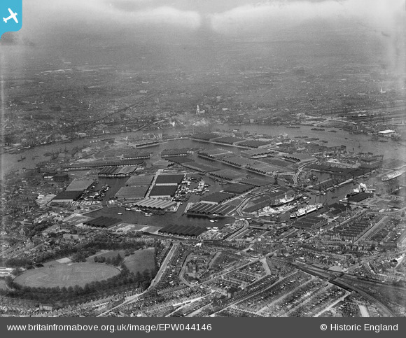
EPW044146 ENGLAND (1934). Surrey Commercial Docks, Rotherhithe, from the south-west, 1934
© Copyright OpenStreetMap contributors and licensed by the OpenStreetMap Foundation. 2026. Cartography is licensed as CC BY-SA.
Nearby Images (6)
EPW044146

EPW060454

EPW044142

EAW164220

EPW035613

EPW036263

Details
| Title | [EPW044146] Surrey Commercial Docks, Rotherhithe, from the south-west, 1934 |
| Reference | EPW044146 |
| Date | May-1934 |
| Link | |
| Place name | ROTHERHITHE |
| Parish | |
| District | |
| Country | ENGLAND |
| Easting / Northing | 535708, 179044 |
| Longitude / Latitude | -0.044915700386752, 51.493546232001 |
| National Grid Reference | TQ357790 |
Pins

User Comment Contributions

St. Anne's Church, Limehouse, 30/09/2014 |

Class31 |
Sunday 5th of October 2014 02:42:07 PM |