
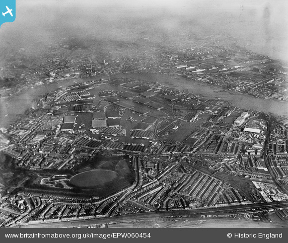
EPW060454 ENGLAND (1939). The Southwark Park Oval and the Surrey Commercial Docks, Rotherhithe, from the south-west, 1939
© Copyright OpenStreetMap contributors and licensed by the OpenStreetMap Foundation. 2026. Cartography is licensed as CC BY-SA.
Nearby Images (4)
EPW060454

EPW044146

EAW164220

EPW044142

Details
| Title | [EPW060454] The Southwark Park Oval and the Surrey Commercial Docks, Rotherhithe, from the south-west, 1939 |
| Reference | EPW060454 |
| Date | 7-February-1939 |
| Link | |
| Place name | ROTHERHITHE |
| Parish | |
| District | |
| Country | ENGLAND |
| Easting / Northing | 535622, 178978 |
| Longitude / Latitude | -0.046179255691376, 51.492973711102 |
| National Grid Reference | TQ356790 |
Pins

Totominet |
Wednesday 31st of October 2018 05:54:53 PM | |

Alan McFaden |
Thursday 14th of November 2013 06:42:23 PM |
