
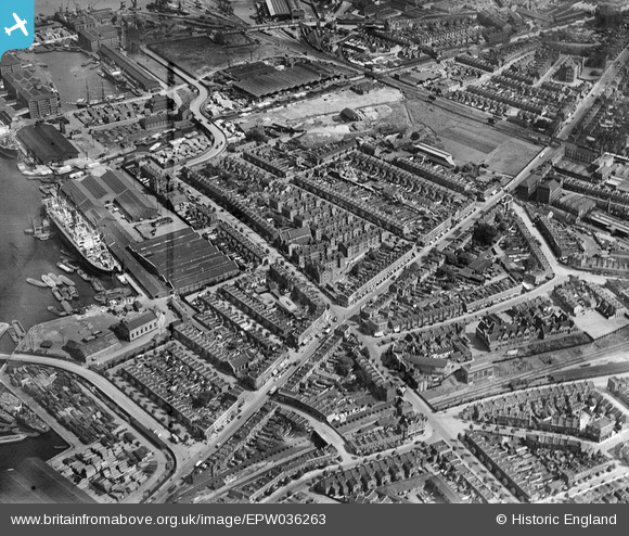
EPW036263 ENGLAND (1931). Sutton Dwellings at Chilton Grove and Lower Road, Rotherhithe, 1931
© Copyright OpenStreetMap contributors and licensed by the OpenStreetMap Foundation. 2026. Cartography is licensed as CC BY-SA.
Nearby Images (16)
EPW036263

EPW035610

EPW036267

EPW036264

EPW035612

EPW035608

EPW035613

EPW035611

EPW036266

EPW036268

EPW035609

EAW033240

EAW033237

EAW033238

EAW033239

EPW044146

Details
| Title | [EPW036263] Sutton Dwellings at Chilton Grove and Lower Road, Rotherhithe, 1931 |
| Reference | EPW036263 |
| Date | August-1931 |
| Link | |
| Place name | ROTHERHITHE |
| Parish | |
| District | |
| Country | ENGLAND |
| Easting / Northing | 535936, 178806 |
| Longitude / Latitude | -0.041724750262382, 51.491352480966 |
| National Grid Reference | TQ359788 |
Pins

Mike Floate |
Monday 22nd of July 2019 08:09:21 AM | |
|
Mike Floate |
Monday 22nd of July 2019 08:04:59 AM |
