
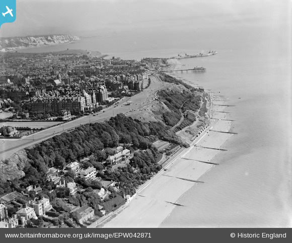
EPW042871 ENGLAND (1933). Radnor Cliff, The Leas and the town, Folkestone, from the south-west, 1933
© Copyright OpenStreetMap contributors and licensed by the OpenStreetMap Foundation. 2026. Cartography is licensed as CC BY-SA.
Nearby Images (19)
EPW042871

EAW002860

EAW002859

EAW002377

EPW035412

EPW019045

EPW035416

EAW002376

EPW000285

EPW000594

EPW035413

EPW042869

EPW026116

EPW042867

EPW009203

EPW019066

EPW009198

EPW000586

EPW026113

Details
| Title | [EPW042871] Radnor Cliff, The Leas and the town, Folkestone, from the south-west, 1933 |
| Reference | EPW042871 |
| Date | August-1933 |
| Link | |
| Place name | FOLKESTONE |
| Parish | SANDGATE |
| District | |
| Country | ENGLAND |
| Easting / Northing | 621405, 135220 |
| Longitude / Latitude | 1.1608846536518, 51.072995247494 |
| National Grid Reference | TR214352 |
Pins
Be the first to add a comment to this image!