
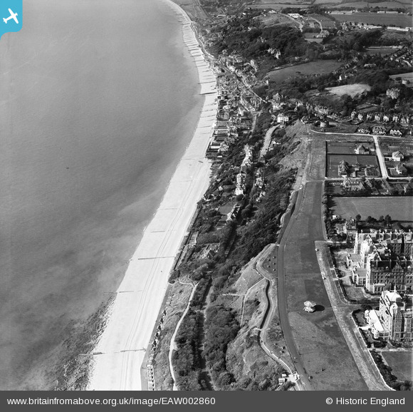
EAW002860 ENGLAND (1946). Radnor Cliff, the seafront and the village, Sandgate, 1946
© Copyright OpenStreetMap contributors and licensed by the OpenStreetMap Foundation. 2026. Cartography is licensed as CC BY-SA.
Nearby Images (12)
EAW002860

EPW042871

EAW002859

EAW002377

EPW035412

EAW032832

EPW019045

EAW002376

EAW032836

EAW032835

EAW032834

EPW026116

Details
| Title | [EAW002860] Radnor Cliff, the seafront and the village, Sandgate, 1946 |
| Reference | EAW002860 |
| Date | 1-October-1946 |
| Link | |
| Place name | SANDGATE |
| Parish | SANDGATE |
| District | |
| Country | ENGLAND |
| Easting / Northing | 621321, 135206 |
| Longitude / Latitude | 1.1596788123386, 51.07290193339 |
| National Grid Reference | TR213352 |
