
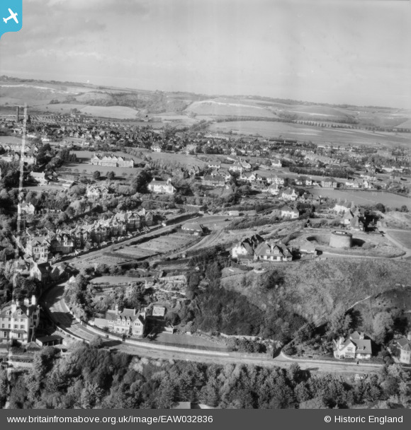
EAW032836 ENGLAND (1950). Radnor Cliff Crescent, Martello Tower no. 4 and environs, Sandgate, from the south, 1950. This image was marked by Aerofilms Ltd for photo editing.
© Copyright OpenStreetMap contributors and licensed by the OpenStreetMap Foundation. 2026. Cartography is licensed as CC BY-SA.
Nearby Images (15)
EAW032836

EAW032833

EAW032835

EAW032834

EAW032832

EPW000585

EPW035412

EAW002376

EAW002377

EPW026113

EPW026117

EAW002858

EPW019045

EAW002859

EAW002860

Details
| Title | [EAW032836] Radnor Cliff Crescent, Martello Tower no. 4 and environs, Sandgate, from the south, 1950. This image was marked by Aerofilms Ltd for photo editing. |
| Reference | EAW032836 |
| Date | 3-October-1950 |
| Link | |
| Place name | SANDGATE |
| Parish | SANDGATE |
| District | |
| Country | ENGLAND |
| Easting / Northing | 621091, 135316 |
| Longitude / Latitude | 1.1564678291635, 51.073978326407 |
| National Grid Reference | TR211353 |
Pins

Paolo |
Saturday 3rd of May 2014 09:10:24 PM |