
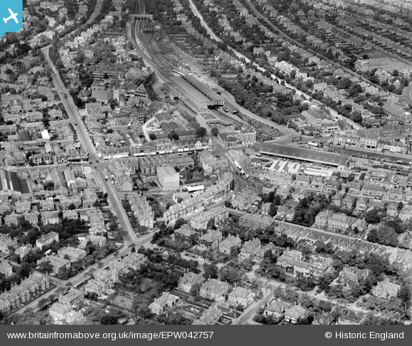
EPW042757 ENGLAND (1933). Bournemouth Station, St Paul's Road and the town centre, Bournemouth, 1933
© Copyright OpenStreetMap contributors and licensed by the OpenStreetMap Foundation. 2026. Cartography is licensed as CC BY-SA.
Nearby Images (20)
EPW042757

EPW042753

EPW042751

EPW042758

EPW042755

EPW042752

EPW042756

EPW042874

EPW042754

EPW042876

EAW033403

EAW033404

EPW042875

EAW033399

EAW033402

EAW033405

EPW046186

EAW033401

EPW042873

EAW033400

Details
| Title | [EPW042757] Bournemouth Station, St Paul's Road and the town centre, Bournemouth, 1933 |
| Reference | EPW042757 |
| Date | August-1933 |
| Link | |
| Place name | BOURNEMOUTH |
| Parish | |
| District | |
| Country | ENGLAND |
| Easting / Northing | 409843, 91781 |
| Longitude / Latitude | -1.8605349177293, 50.724994237266 |
| National Grid Reference | SZ098918 |
Pins

Jb1 |
Friday 6th of June 2025 11:33:25 AM |