
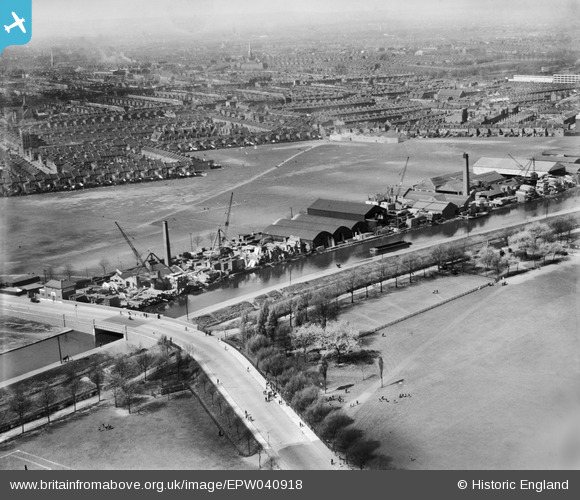
EPW040918 ENGLAND (1933). The G. Surrey Ltd Timber Yard, Marshgate Bridge and the River Lee Navigation, Homerton, from the east, 1933
© Copyright OpenStreetMap contributors and licensed by the OpenStreetMap Foundation. 2026. Cartography is licensed as CC BY-SA.
Nearby Images (16)
EPW040918

EPW043989

EPW043988

EPW043987

EPW044839

EPW044837

EPW043990

EPW044838

EPW040915

EPW040916

EPW040913

EPW040914

EPW040912

EPW040917

EPW005649

EPW005647

Details
| Title | [EPW040918] The G. Surrey Ltd Timber Yard, Marshgate Bridge and the River Lee Navigation, Homerton, from the east, 1933 |
| Reference | EPW040918 |
| Date | April-1933 |
| Link | |
| Place name | HOMERTON |
| Parish | |
| District | |
| Country | ENGLAND |
| Easting / Northing | 536700, 185527 |
| Longitude / Latitude | -0.02811769834718, 51.551570896145 |
| National Grid Reference | TQ367855 |
Pins

Marko |
Wednesday 15th of April 2020 12:49:39 PM |