
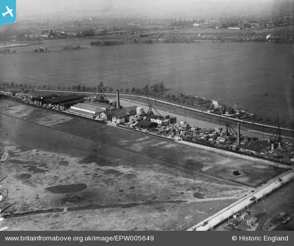
EPW005649 ENGLAND (1921). Factories and wharves alongside the Hackney Cut Navigation, Hackney Marsh, 1921
© Copyright OpenStreetMap contributors and licensed by the OpenStreetMap Foundation. 2026. Cartography is licensed as CC BY-SA.
Nearby Images (16)
EPW005649

EPW040912

EPW005647

EPW040913

EPW040914

EPW040917

EPW040915

EPW040916

EPW044838

EPW043987

EPW043988

EPW043990

EPW044839

EPW044837

EPW043989

EPW040918

Details
| Title | [EPW005649] Factories and wharves alongside the Hackney Cut Navigation, Hackney Marsh, 1921 |
| Reference | EPW005649 |
| Date | March-1921 |
| Link | |
| Place name | HACKNEY MARSH |
| Parish | |
| District | |
| Country | ENGLAND |
| Easting / Northing | 536543, 185622 |
| Longitude / Latitude | -0.030344079374682, 51.552462695282 |
| National Grid Reference | TQ365856 |
Pins
Be the first to add a comment to this image!