
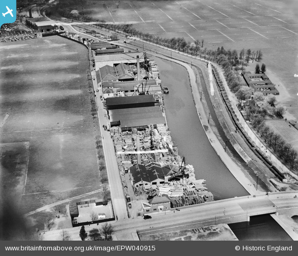
EPW040915 ENGLAND (1933). The G. Surrey Ltd Timber Yard, Marshgate Bridge and the River Lee Navigation, Homerton, 1933
© Copyright OpenStreetMap contributors and licensed by the OpenStreetMap Foundation. 2026. Cartography is licensed as CC BY-SA.
Nearby Images (16)
EPW040915

EPW040916

EPW044838

EPW040914

EPW040917

EPW040913

EPW040912

EPW043987

EPW043988

EPW043990

EPW005649

EPW005647

EPW044839

EPW044837

EPW043989

EPW040918

Details
| Title | [EPW040915] The G. Surrey Ltd Timber Yard, Marshgate Bridge and the River Lee Navigation, Homerton, 1933 |
| Reference | EPW040915 |
| Date | April-1933 |
| Link | |
| Place name | HOMERTON |
| Parish | |
| District | |
| Country | ENGLAND |
| Easting / Northing | 536564, 185552 |
| Longitude / Latitude | -0.030068526730795, 51.551828514175 |
| National Grid Reference | TQ366856 |
Pins
Be the first to add a comment to this image!