
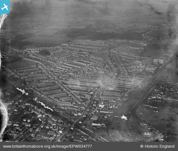
EPW034777 ENGLAND (1931). Residential area around St Albans Road and Leavesden Road, North Watford, 1931
© Copyright OpenStreetMap contributors and licensed by the OpenStreetMap Foundation. 2026. Cartography is licensed as CC BY-SA.
Nearby Images (6)
EPW034777

EPW034778

EPW034773

EPW034774

EAW028658

EPW034783

Details
| Title | [EPW034777] Residential area around St Albans Road and Leavesden Road, North Watford, 1931 |
| Reference | EPW034777 |
| Date | January-1931 |
| Link | |
| Place name | NORTH WATFORD |
| Parish | |
| District | |
| Country | ENGLAND |
| Easting / Northing | 510834, 198347 |
| Longitude / Latitude | -0.39700196249518, 51.672483311321 |
| National Grid Reference | TQ108983 |
Pins

jaewood |
Saturday 22nd of October 2016 10:42:43 PM | |
|
jaewood |
Saturday 22nd of October 2016 10:42:07 PM | |
|
jaewood |
Saturday 22nd of October 2016 10:41:49 PM | |
|
jaewood |
Saturday 22nd of October 2016 10:41:00 PM | |
|
jaewood |
Saturday 22nd of October 2016 10:40:01 PM | |
|
jaewood |
Saturday 22nd of October 2016 10:39:13 PM |