
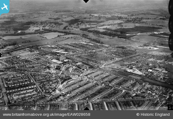
EAW028658 ENGLAND (1950). The town, Watford, from the west, 1950
© Copyright OpenStreetMap contributors and licensed by the OpenStreetMap Foundation. 2026. Cartography is licensed as CC BY-SA.
Nearby Images (6)
EAW028658

EPW034773

EPW034783

EPW034777

EPW034778

EPW034774

Details
| Title | [EAW028658] The town, Watford, from the west, 1950 |
| Reference | EAW028658 |
| Date | 5-April-1950 |
| Link | |
| Place name | WATFORD |
| Parish | |
| District | |
| Country | ENGLAND |
| Easting / Northing | 510868, 198197 |
| Longitude / Latitude | -0.39655804614876, 51.671128293123 |
| National Grid Reference | TQ109982 |
Pins

Brian |
Thursday 17th of November 2022 11:04:01 PM | |
|
Brian |
Thursday 17th of November 2022 09:54:59 PM | |
|
Brian |
Wednesday 27th of May 2020 10:04:54 PM | |
|
Bluid |
Friday 28th of February 2014 11:21:57 AM | |
The large building is the Ministry of Labour Training Centre |
The Laird |
Saturday 11th of July 2015 02:46:21 PM |
|
Bluid |
Wednesday 19th of February 2014 11:46:04 PM | |
|
Bluid |
Wednesday 19th of February 2014 11:44:08 PM | |
|
Bluid |
Wednesday 19th of February 2014 11:42:56 PM |