
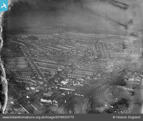
EPW034773 ENGLAND (1931). Residential area around St Albans Road and Leavesden Road, North Watford, 1931
© Copyright OpenStreetMap contributors and licensed by the OpenStreetMap Foundation. 2026. Cartography is licensed as CC BY-SA.
Nearby Images (6)
EPW034773

EAW028658

EPW034777

EPW034783

EPW034778

EPW034774

Details
| Title | [EPW034773] Residential area around St Albans Road and Leavesden Road, North Watford, 1931 |
| Reference | EPW034773 |
| Date | January-1931 |
| Link | |
| Place name | NORTH WATFORD |
| Parish | |
| District | |
| Country | ENGLAND |
| Easting / Northing | 510869, 198259 |
| Longitude / Latitude | -0.39652390697441, 51.67168539633 |
| National Grid Reference | TQ109983 |
Pins
Be the first to add a comment to this image!