
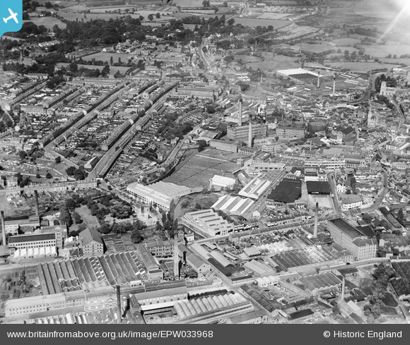
EPW033968 ENGLAND (1930). Carpet Works and factories in the town centre, Kidderminster, 1930
© Copyright OpenStreetMap contributors and licensed by the OpenStreetMap Foundation. 2026. Cartography is licensed as CC BY-SA.
Nearby Images (27)
EPW033968

EPW001297

EPW033975

EPW033976

EPW033970

EPW033971

EPW059213

EPW059212

EPW059217

EPW059214

EPW059211

EPW033973

EPW059215

EPW037599

EPW059216

EPW037602

EPW034227

EPW037603

EPW033972

EPW037601

EPW059218

EPW033969

EPW059861

EPW033978

EPW033979

EPW037600

EPW033977

Details
| Title | [EPW033968] Carpet Works and factories in the town centre, Kidderminster, 1930 |
| Reference | EPW033968 |
| Date | July-1930 |
| Link | |
| Place name | KIDDERMINSTER |
| Parish | |
| District | |
| Country | ENGLAND |
| Easting / Northing | 383010, 276442 |
| Longitude / Latitude | -2.2496587449973, 52.385363907763 |
| National Grid Reference | SO830764 |
Pins
Be the first to add a comment to this image!