
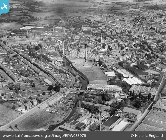
EPW033979 ENGLAND (1930). The town centre, Kidderminster, from the south, 1930
© Copyright OpenStreetMap contributors and licensed by the OpenStreetMap Foundation. 2026. Cartography is licensed as CC BY-SA.
Nearby Images (24)
EPW033979

EPW033972

EPW033969

EPW033974

EPW033973

EPW033977

EPW034227

EPW033970

EPW033971

EPW059212

EPW037599

EPW059215

EPW033976

EPW033975

EPW059213

EPW059217

EPW059211

EPW001297

EPW033968

EPW037611

EPW059216

EPW059214

EPW037602

EPW059218

Details
| Title | [EPW033979] The town centre, Kidderminster, from the south, 1930 |
| Reference | EPW033979 |
| Date | July-1930 |
| Link | |
| Place name | KIDDERMINSTER |
| Parish | |
| District | |
| Country | ENGLAND |
| Easting / Northing | 383013, 276217 |
| Longitude / Latitude | -2.2496032529147, 52.383341010555 |
| National Grid Reference | SO830762 |
Pins

fossil |
Sunday 23rd of March 2014 05:05:08 PM | |
|
alanpreece |
Sunday 23rd of February 2014 04:46:59 PM | |
|
alanpreece |
Sunday 23rd of February 2014 04:46:30 PM | |
|
alanpreece |
Sunday 23rd of February 2014 04:45:25 PM | |
|
alanpreece |
Sunday 23rd of February 2014 04:44:56 PM | |
|
alanpreece |
Sunday 23rd of February 2014 04:43:25 PM | |
|
alanpreece |
Sunday 23rd of February 2014 04:42:31 PM | |
|
alanpreece |
Sunday 23rd of February 2014 04:41:44 PM | |
|
alanpreece |
Sunday 23rd of February 2014 04:40:20 PM | |
|
alanpreece |
Sunday 23rd of February 2014 04:39:05 PM |