
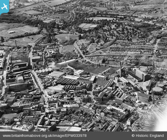
EPW033978 ENGLAND (1930). The town centre, Kidderminster, from the north-east, 1930
© Copyright OpenStreetMap contributors and licensed by the OpenStreetMap Foundation. 2026. Cartography is licensed as CC BY-SA.
Nearby Images (25)
EPW033978

EPW037601

EPW037600

EPW037603

EPW059218

EPW037602

EPW059214

EPW059216

EPW059211

EPW034233

EPW059217

EPW059861

EPW059213

EPW059215

EPW037599

EPW059212

EPW033971

EPW037605

EPW033976

EPW001297

EPW033968

EPW033975

EPW001295

EPW033973

EPW033970

Details
| Title | [EPW033978] The town centre, Kidderminster, from the north-east, 1930 |
| Reference | EPW033978 |
| Date | July-1930 |
| Link | |
| Place name | KIDDERMINSTER |
| Parish | |
| District | |
| Country | ENGLAND |
| Easting / Northing | 383213, 276541 |
| Longitude / Latitude | -2.2466807627296, 52.386260285723 |
| National Grid Reference | SO832765 |
