
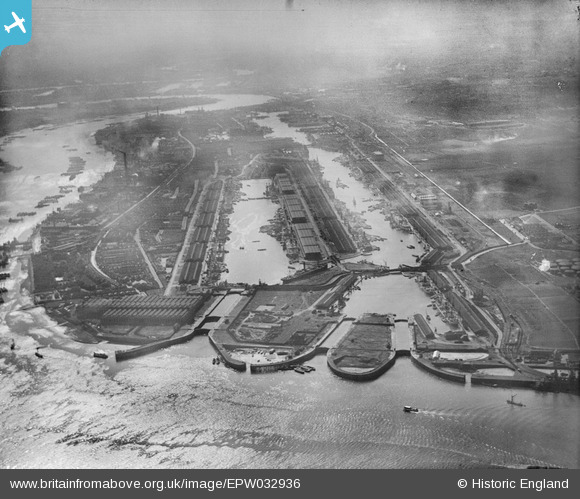
EPW032936 ENGLAND (1930). The Royal Albert Dock and King George V Dock, North Woolwich, 1930
© Copyright OpenStreetMap contributors and licensed by the OpenStreetMap Foundation. 2026. Cartography is licensed as CC BY-SA.
Nearby Images (22)
EPW032936

EPW010727

EAW022357

EAW008725

EAW021703

EPW032937

EAW008726

EAW000057

EAW005289

EAW000058

EAW000054

EAW049351

EAW008727

EPW032935

EAW000051

EPW021370

EPW008887

EAW016657

EAW000050

EAW021713

EAW008722

EAW000037

Details
| Title | [EPW032936] The Royal Albert Dock and King George V Dock, North Woolwich, 1930 |
| Reference | EPW032936 |
| Date | June-1930 |
| Link | |
| Place name | NORTH WOOLWICH |
| Parish | |
| District | |
| Country | ENGLAND |
| Easting / Northing | 543258, 180477 |
| Longitude / Latitude | 0.064361807725594, 51.504561226557 |
| National Grid Reference | TQ433805 |
Pins
Be the first to add a comment to this image!