
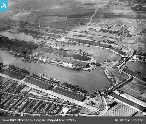
EPW032935 ENGLAND (1930). The Royal Albert Dock and King George V Dock, North Woolwich, 1930
© Copyright OpenStreetMap contributors and licensed by the OpenStreetMap Foundation. 2026. Cartography is licensed as CC BY-SA.
Nearby Images (25)
EPW032935

EPW008887

EAW008722

EAW005290

EAW008723

EAW022357

EAW049351

EPW008885

EAW000051

EPW032936

EAW008726

EAW000058

EAW000057

EPW010727

EAW005289

EAW008724

EAW000054

EAW016657

EAW008725

EAW014133

EAW021703

EPW032937

EAW008728

EAW000050

EAW022358

Details
| Title | [EPW032935] The Royal Albert Dock and King George V Dock, North Woolwich, 1930 |
| Reference | EPW032935 |
| Date | June-1930 |
| Link | |
| Place name | NORTH WOOLWICH |
| Parish | |
| District | |
| Country | ENGLAND |
| Easting / Northing | 543404, 180468 |
| Longitude / Latitude | 0.066460551029681, 51.504443313173 |
| National Grid Reference | TQ434805 |
Pins

John W |
Monday 2nd of May 2016 06:03:26 PM |