
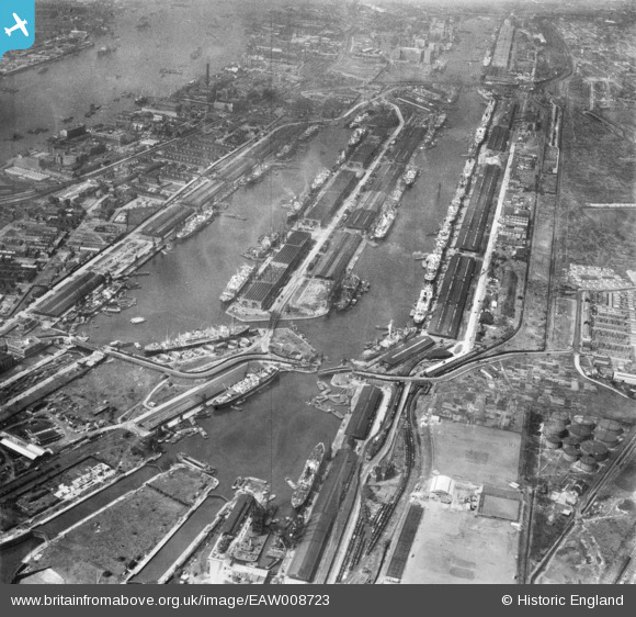
EAW008723 ENGLAND (1947). The Royal Albert Dock and the King George V Dock, North Woolwich, 1947
© Copyright OpenStreetMap contributors and licensed by the OpenStreetMap Foundation. 2026. Cartography is licensed as CC BY-SA.
Nearby Images (17)
EAW008723

EAW005290

EPW008887

EAW008722

EPW008885

EAW008724

EPW032935

EAW008728

EAW014133

EAW022358

EPW044121

EAW000051

EAW016657

EAW049351

EAW022357

EAW008726

EAW000050

Details
| Title | [EAW008723] The Royal Albert Dock and the King George V Dock, North Woolwich, 1947 |
| Reference | EAW008723 |
| Date | 8-August-1947 |
| Link | |
| Place name | NORTH WOOLWICH |
| Parish | |
| District | |
| Country | ENGLAND |
| Easting / Northing | 543511, 180494 |
| Longitude / Latitude | 0.068011928787457, 51.504649800868 |
| National Grid Reference | TQ435805 |
Pins

redmist |
Monday 29th of June 2020 07:49:29 PM | |
|
redmist |
Monday 29th of June 2020 07:48:01 PM | |
|
redmist |
Monday 29th of June 2020 07:47:22 PM |