
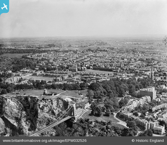
EPW032526 ENGLAND (1930). The Clifton Suspension Bridge, Observatory Hill and the city, Bristol, from the south-west, 1930
© Copyright OpenStreetMap contributors and licensed by the OpenStreetMap Foundation. 2026. Cartography is licensed as CC BY-SA.
Nearby Images (18)
EPW032526

EPW048299

EPW049535

EPW041480

EPW037150

EAW015138

EAW033327

EPW001274

EPW048295

EAW050560

EPW012024

EAW033323

EPR000063

EAW016132

EAW033325

EAW050559

EPW022272

EAW050558

Details
| Title | [EPW032526] The Clifton Suspension Bridge, Observatory Hill and the city, Bristol, from the south-west, 1930 |
| Reference | EPW032526 |
| Date | July-1930 |
| Link | |
| Place name | BRISTOL |
| Parish | |
| District | |
| Country | ENGLAND |
| Easting / Northing | 356644, 173212 |
| Longitude / Latitude | -2.6240699276029, 51.455736999493 |
| National Grid Reference | ST566732 |
