
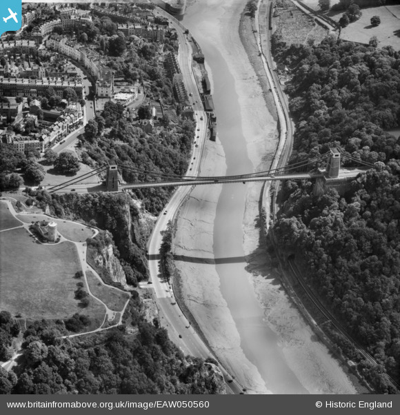
EAW050560 ENGLAND (1953). The Clifton Suspension Bridge, Clifton, 1953
© Copyright OpenStreetMap contributors and licensed by the OpenStreetMap Foundation. 2026. Cartography is licensed as CC BY-SA.
Nearby Images (21)
EAW050560

EPW001274

EPW037150

EAW016132

EPR000063

EAW033325

EAW050559

EAW015138

EPW041480

EPW022272

EAW033323

EAW050558

EAW033327

EPW012024

EPW032539

EPW032526

EAW002263

EPW022273

EPW048299

EPW049535

EPW048295

Details
| Title | [EAW050560] The Clifton Suspension Bridge, Clifton, 1953 |
| Reference | EAW050560 |
| Date | 9-July-1953 |
| Link | |
| Place name | CLIFTON |
| Parish | |
| District | |
| Country | ENGLAND |
| Easting / Northing | 356503, 173115 |
| Longitude / Latitude | -2.6260874309293, 51.454853952751 |
| National Grid Reference | ST565731 |
Pins

Matt Aldred edob.mattaldred.com |
Thursday 2nd of June 2022 11:42:52 PM |