
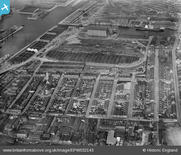
EPW032143 ENGLAND (1930). The Western Granaries and Grain Depot, Millwall, 1930
© Copyright OpenStreetMap contributors and licensed by the OpenStreetMap Foundation. 2026. Cartography is licensed as CC BY-SA.
Nearby Images (13)
EPW032143

EPW032140

EPW032141

EPW032137

EPW032136

EPW032139

EPW032138

EPW032142

EPW044128

EAW009114

EPW044135

EAW045808

EPW006141

Details
| Title | [EPW032143] The Western Granaries and Grain Depot, Millwall, 1930 |
| Reference | EPW032143 |
| Date | May-1930 |
| Link | |
| Place name | MILLWALL |
| Parish | |
| District | |
| Country | ENGLAND |
| Easting / Northing | 537366, 179625 |
| Longitude / Latitude | -0.020818660164216, 51.498367291786 |
| National Grid Reference | TQ374796 |
