
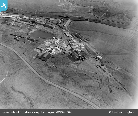
EPW026767 ENGLAND (1929). The Shap Granite Works, Shap, 1929
© Copyright OpenStreetMap contributors and licensed by the OpenStreetMap Foundation. 2025. Cartography is licensed as CC BY-SA.
Nearby Images (8)
EPW026767

EPW026762

EPW026765

EPW026761

EPW026759

EPW026764

EPW026763

EPW026766

Details
| Title | [EPW026767] The Shap Granite Works, Shap, 1929 |
| Reference | EPW026767 |
| Date | May-1929 |
| Link | |
| Place name | SHAP |
| Parish | SHAP |
| District | |
| Country | ENGLAND |
| Easting / Northing | 356800, 511048 |
| Longitude / Latitude | -2.6670146250967, 54.49279118415 |
| National Grid Reference | NY568110 |
Pins

Martin |
Monday 27th of January 2014 03:52:13 PM |