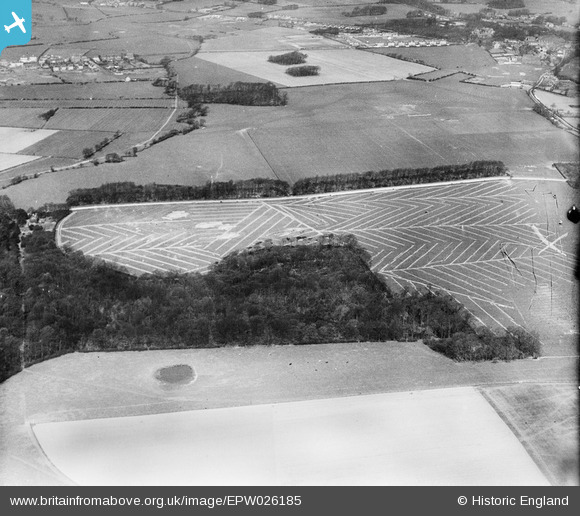
EPW026185 ENGLAND (1929). Gorse Covert and adjoining fields at Arrowe Hill, Birkenhead, 1929

© Copyright OpenStreetMap contributors and licensed by the OpenStreetMap Foundation. 2026. Cartography is licensed as CC BY-SA.

Nearby Images (4)

EPW026185
  0° 0m
EPW026183
  267° 20m
EPW026184
  80° 22m
EPW026186
  113° 153m

Details

Title [EPW026185] Gorse Covert and adjoining fields at Arrowe Hill, Birkenhead, 1929
Reference EPW026185
Date April-1929
Link
Place name BIRKENHEAD
Parish
District
Country ENGLAND
Easting / Northing 326773, 386861
Longitude / Latitude -3.1007841969513, 53.373263001719
National Grid Reference SJ268869

Pins

Saughall Massie Road/Overchurch Road, with the (wonderful) "PoPp"Evans' general store. The Wirral Milk depot a hundred yards off-photo to the left).

Roger Reid
Tuesday 18th of February 2014 12:21:38 AM
(1) Upton Cricket Club with its clubhouse. (2) Adams' farm fields "everywhere" (3) The brook between Upton and Greasby, with site of later "Twelfth Man". (4) "The Big Wood" to become a focal point of Greasby youth life.

Roger Reid
Tuesday 18th of February 2014 12:14:37 AM
Before (a) Warwick Hey Development and Saughall Massie Road, including Kirkway (where I was born) were constructed in the mid-thirties. (1) The lone copse would become a main feature to Warwick Hey Park. (2) The hedge behind that copse parallels Warwick Road, from Saughall Massie Rd to - Copse throughway to Overchurch Estate - copse at Moreton Road. (3) Behind are (a) Brassie's Farm/Brassie's pond (the square enclosures) (b) the larger "Witch's Wood" and "The Far Wood".

Roger Reid
Tuesday 18th of February 2014 12:08:57 AM
Upton Village. Just at the start of the suburban explosion.... (1) The "posh" areas, like the north east quadrant, just built. West Drive and its copse, St Mary's Vicarage; with "the circular wood" behind being behind Upland Road to the right of (later) Overchurch Jr School. (2)The main road from Arrow being the very narrow Rake Lane, finishing between The Eagle & Crown and The Horse & Jockey (replaced by Boots Chemist); before the first Upton Bypass was run straight to Moreton Road - to the right of The Convent and the old "haunted house". A large white shed where the petrol service now stands (beside Upton Bypass). No "cop shop" yet. (3) Long before "the pre-fabs were built on the south west quadrant (Molyneux Close area).

Roger Reid
Monday 17th of February 2014 11:55:47 PM
Rear entrance to Arrowe Park by Park Keepers cottage

JEAN
Tuesday 6th of November 2012 05:04:00 PM
Upton Village(?)

JEAN
Tuesday 6th of November 2012 05:03:01 PM
Site of the new hospital built in the 70'(?)

JEAN
Tuesday 6th of November 2012 05:02:06 PM
Arrowe Park, field used in the 60's(?) for football pitches

JEAN
Tuesday 6th of November 2012 05:01:03 PM