
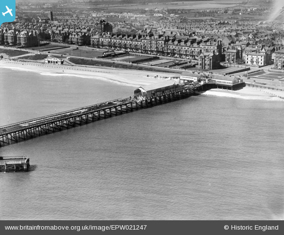
EPW021247 ENGLAND (1928). Claremont Pier and the seafront, Lowestoft, from the east, 1928
© Copyright OpenStreetMap contributors and licensed by the OpenStreetMap Foundation. 2025. Cartography is licensed as CC BY-SA.
Nearby Images (6)
EPW021247

EAW025477

EPW001897

EPW021240

EAW025478

EAW005062

Details
| Title | [EPW021247] Claremont Pier and the seafront, Lowestoft, from the east, 1928 |
| Reference | EPW021247 |
| Date | May-1928 |
| Link | |
| Place name | LOWESTOFT |
| Parish | |
| District | |
| Country | ENGLAND |
| Easting / Northing | 654645, 291901 |
| Longitude / Latitude | 1.7493187106473, 52.465180326179 |
| National Grid Reference | TM546919 |
Pins

Eddy |
Thursday 20th of August 2020 08:08:31 PM | |
Robert Tims |
Tuesday 10th of September 2013 11:23:47 AM |