
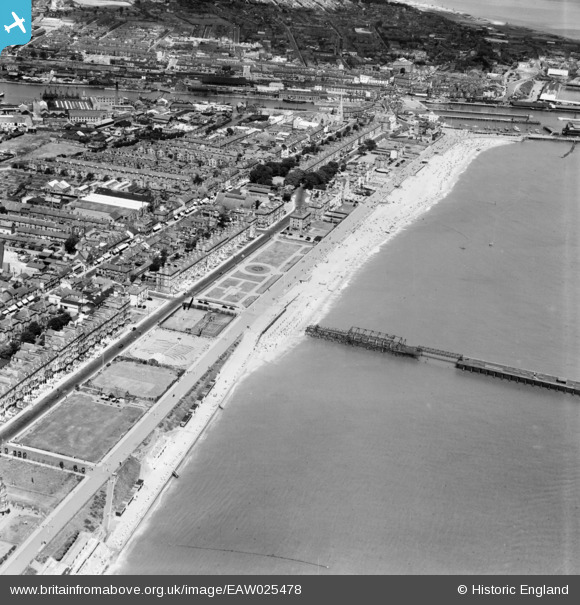
EAW025478 ENGLAND (1949). The Esplanade and beach, Lowestoft, 1949
© Copyright OpenStreetMap contributors and licensed by the OpenStreetMap Foundation. 2025. Cartography is licensed as CC BY-SA.
Nearby Images (6)
EAW025478

EAW025477

EPW021240

EPW001897

EPW021247

EAW005062

Details
| Title | [EAW025478] The Esplanade and beach, Lowestoft, 1949 |
| Reference | EAW025478 |
| Date | 28-July-1949 |
| Link | |
| Place name | LOWESTOFT |
| Parish | |
| District | |
| Country | ENGLAND |
| Easting / Northing | 654536, 292002 |
| Longitude / Latitude | 1.7477946237085, 52.466137283921 |
| National Grid Reference | TM545920 |
Pins
Be the first to add a comment to this image!