
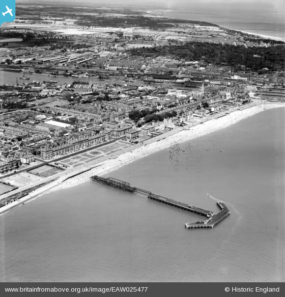
EAW025477 ENGLAND (1949). Claremont Pier and the town, Lowestoft, from the south, 1949
© Copyright OpenStreetMap contributors and licensed by the OpenStreetMap Foundation. 2025. Cartography is licensed as CC BY-SA.
Nearby Images (6)
EAW025477

EPW001897

EPW021240

EPW021247

EAW025478

EAW005062

Details
| Title | [EAW025477] Claremont Pier and the town, Lowestoft, from the south, 1949 |
| Reference | EAW025477 |
| Date | 28-July-1949 |
| Link | |
| Place name | LOWESTOFT |
| Parish | |
| District | |
| Country | ENGLAND |
| Easting / Northing | 654608, 291900 |
| Longitude / Latitude | 1.7487744368524, 52.465188603425 |
| National Grid Reference | TM546919 |
Pins

Brightonboy |
Monday 14th of November 2016 09:29:45 PM | |
|
Brightonboy |
Monday 14th of November 2016 09:27:16 PM | |
|
Brightonboy |
Monday 14th of November 2016 09:26:00 PM | |
|
Brightonboy |
Monday 14th of November 2016 09:23:54 PM | |
|
Brightonboy |
Monday 14th of November 2016 09:22:16 PM | |
|
Brightonboy |
Monday 14th of November 2016 09:21:15 PM | |
|
Brightonboy |
Monday 14th of November 2016 09:20:06 PM | |
|
Brightonboy |
Monday 14th of November 2016 09:18:15 PM | |
|
Brightonboy |
Monday 14th of November 2016 09:15:41 PM | |
|
Brightonboy |
Saturday 21st of December 2013 11:06:51 PM | |
|
Brightonboy |
Saturday 21st of December 2013 11:05:36 PM |