
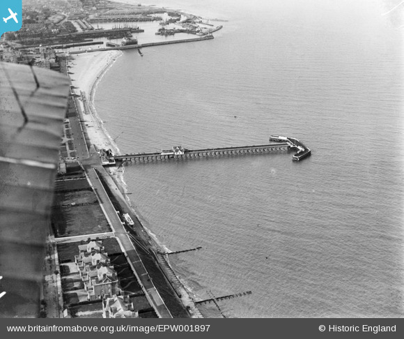
EPW001897 ENGLAND (1920). Claremont Pier and Lowestoft Harbour, Lowestoft, 1920
© Copyright OpenStreetMap contributors and licensed by the OpenStreetMap Foundation. 2025. Cartography is licensed as CC BY-SA.
Nearby Images (6)
EPW001897

EAW025477

EPW021240

EPW021247

EAW025478

EAW005062

Details
| Title | [EPW001897] Claremont Pier and Lowestoft Harbour, Lowestoft, 1920 |
| Reference | EPW001897 |
| Date | June-1920 |
| Link | |
| Place name | LOWESTOFT |
| Parish | |
| District | |
| Country | ENGLAND |
| Easting / Northing | 654602, 291884 |
| Longitude / Latitude | 1.7486740885223, 52.465047851918 |
| National Grid Reference | TM546919 |
Pins
Be the first to add a comment to this image!