
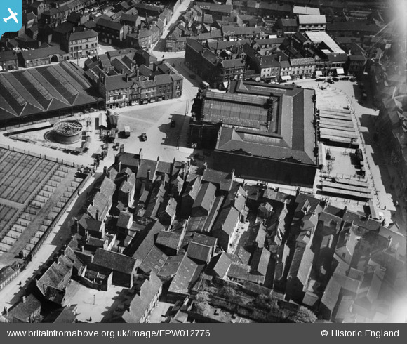
EPW012776 ENGLAND (1925). The Market Hall and Corn Exchange, Doncaster, 1925
© Copyright OpenStreetMap contributors and licensed by the OpenStreetMap Foundation. 2026. Cartography is licensed as CC BY-SA.
Nearby Images (28)
EPW012776

EPW061937

EPW061935

EPW061934

EPW012760

EPW012775

EPW012772

EAW044183
 Flour Mill and St George's Church, Doncaster, 1952. This image was marked by Aerofilms Ltd for photo editing.")
EPW012767

EAW043791

EAW043788

EPW061936

EAW043792

EAW044180
 Flour Mill and environs, Doncaster, 1952. This image was marked by Aerofilms Ltd for photo editing.")
EPW012756

EPW012774

EAW043790

EAW044182
 Flour Mill and St George's Church, Doncaster, 1952. This image was marked by Aerofilms Ltd for photo editing.")
EAW044184
 Flour Mill and St George's Church, Doncaster, 1952. This image was marked by Aerofilms Ltd for photo editing.")
EAW043786

EAW044181
 Flour Mill and environs, Doncaster, 1952. This image was marked by Aerofilms Ltd for photo editing.")
EAW044185
 Flour Mill and environs, Doncaster, 1952. This image was marked by Aerofilms Ltd for photo editing.")
EAW044186
 Flour Mill, St George's Church and environs, Doncaster, 1952. This image was marked by Aerofilms Ltd for photo editing.")
EAW044179
 Flour Mill and St George's Church, Doncaster, 1952. This image was marked by Aerofilms Ltd for photo editing.")
EPW012757

EAW044178
 Flour Mill and environs, Doncaster, 1952. This image was marked by Aerofilms Ltd for photo editing.")
EAW043785

EAW043787

Details
| Title | [EPW012776] The Market Hall and Corn Exchange, Doncaster, 1925 |
| Reference | EPW012776 |
| Date | 15-May-1925 |
| Link | |
| Place name | DONCASTER |
| Parish | |
| District | |
| Country | ENGLAND |
| Easting / Northing | 457582, 403494 |
| Longitude / Latitude | -1.1313203776026, 53.524705669811 |
| National Grid Reference | SE576035 |
Pins

jonron |
Saturday 5th of August 2023 02:54:13 AM | |
|
Retired Railwayman |
Friday 31st of August 2012 12:06:37 AM | |
|
Rob Daniels |
Thursday 19th of July 2012 12:31:43 PM | |
|
Rob Daniels |
Thursday 19th of July 2012 12:30:52 PM |