
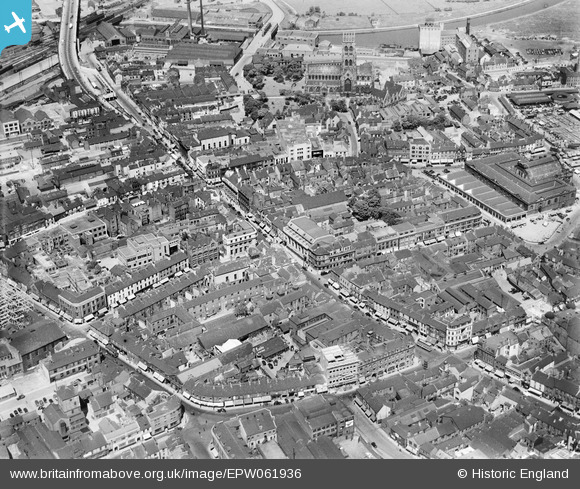
EPW061936 ENGLAND (1939). High Street and environs, Doncaster, 1939
© Copyright OpenStreetMap contributors and licensed by the OpenStreetMap Foundation. 2026. Cartography is licensed as CC BY-SA.
Nearby Images (11)
EPW061936

EPW012756

EPW012775

EPW012774

EPW061935

EPW012777

EPW012760

EPW012776

EPW061930

EPW012773

EPW012767

Details
| Title | [EPW061936] High Street and environs, Doncaster, 1939 |
| Reference | EPW061936 |
| Date | 6-June-1939 |
| Link | |
| Place name | DONCASTER |
| Parish | |
| District | |
| Country | ENGLAND |
| Easting / Northing | 457489, 403316 |
| Longitude / Latitude | -1.1327558765969, 53.523115919124 |
| National Grid Reference | SE575033 |
Pins
Be the first to add a comment to this image!